This weekend I got an incredible book about San Francisco called San Francisco in Maps & Views. I usually avoid glossy coffee-table historical books because they're so often filled with disappointments — bad color, bad printing, messy layout, uninspired writing, PLUS they're really expensive. But THIS ONE. This one is different. The maps are very well-reproduced, high-res and colorful, and all are supported by detailed and surprisingly engaging commentary. After I got over the initial thrill of using it like a flip-book and watching my neighborhood evolve, I started to notice smaller trends in land-use evolution — a plot labeled "orphan asylum" became "hospital;" many things labeled "cemetary" became "park" or "civic center." "Dunes" become "the Sunset." I was also intrigued by the use of public places as refugee camps after the big one hit in 1906. Apparently, SF carpenters sprang into action and built thousands of makeshift cottages for the earthquake/fire refugees, turning many well-known SF public spaces into refugee camps, including South Park, Dolores Park, and Precita Park, and lots of the then-outlying, undeveloped areas, like the Richmond and the Sunset.
 A shack on Bikini Ridge would have been puh-retty sweet. (This is Dolores Park, believe it or not). Photo: Western Neighborhoods Project
As the city began to return to normal a year later, a few of the refugees decided to use the cottages — or, "shacks" as they were commonly known — as more permanent residences. Some industrious people combined multiple shacks into one residence. Incredibly, a few shacks are still around, and naturally folks have organized to preserve them. (Here's a 2002 Chronicle article about efforts to save some shacks in the outer Sunset).
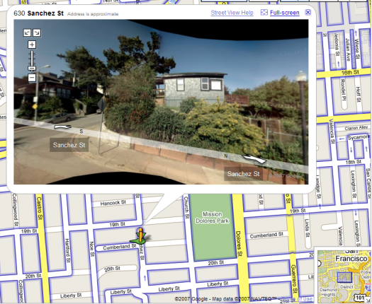
 I believe that this is the house that is listed as 300 Cumberland on the Western Neighborhood Project's list of known shacks. The crazy thing is that this is at the top of an insanely steep hill, like un-bike-ably steep and long, so it must have been built there rather than transported from Dolores Park. On the other hand, who knows? People were crafty back then, right?
Finally, here's a map of the locations of the known existing earthquake shacks. Seems like a good project for a weekend afternoon.
